|
|
DIANA / ARTEMISA / EFESO (SIETE IGLESIAS DE APOCALIPSIS)
| Reply |
Message 5 of 5 on the subject |
|
|
|
|
|
Together with Bat Boy, and Elvis the “Face on Mars” has haunted supermarket checkout Tabloids for years. NASA scientists call it merely an interesting rock formation that happens to look like a face. The faithful call it an artificial monument created by Martians as a sign, perhaps a warning, to us or other Aliens.
Where on Mars
The Face is a large mountain or mesa in the Cydonia region of Mars. It is located at around the 40.8° N, 9.6° W, that’s 40.8°N of the Martian equator. Approximately 3 km long and 1.5 km wide the face was first photographed on July 25, 1976, when the Viking 1 space probe was in orbit taking pictures. The Viking 1 was snapping photos of possible landing sites for its companion ship, Viking 2 when it shot what appeared to be a giant head.
The Viking spacecraft beamed the potential landing sites back to earth where NASA planners pored over the images to find a landing spot. When NASA scientists first saw the head the facial features were thought of as a neat coincidence. The decision was made to release the image in the hopes of spurring the public’s interest in Mars and space exploration in general.

Caption of JPL Viking Press Release P-17384 NATIONAL AERONAUTICS AND SPACE ADMINISTRATION VIKING NEWS CENTER PASADENA, CALIFORNIA (213) 354-6000 Viking 1-61
P-17384 (35A72)
PHOTO CAPTION
July 31, 1976
This picture is one of many taken in the northern latitudes of Mars by the Viking 1 Orbiter in search of a landing site for Viking 2. It shows eroded mesa-like landforms. The huge rock formation in the center, which resembles a human head, is formed by shadows giving the illusion of eyes, nose, and mouth. The feature is 1.5 kilometers (one mile) across, with the sun angle at approximately 20 degrees. The speckled appearance of the image is due to bit errors, emphasized by enlargement of the photo. The picture was taken on July 25 from a range of 1873 kilometers (1162 miles). Viking 2 will arrive in Mars orbit next Saturday (August 7) with a landing scheduled for early September.
Cydonia
Cydonia, the area of Mars where the face is located is covered with mesas that rise high in the air, the surrounding areas having been eroded by the thin Martian air, and possibly water, over billions of years. NASA Scientists saw the image as a simply a large mountain similar to mesa’s found in Arizona deserts. The low image resolution of Viking camera made the “face’s” features appear smoother than what they would be in real life. Plus the shadows give the perception of facial features. After all the brain is trained to find patterns, especially faces, in the things we see around us which is why we see things in clouds or the man on the moon. This brain’s function even has a name: pareidolia (payr.eye.DOH.lee.uh) n. The erroneous or fanciful perception of a pattern or meaning in something that is actually ambiguous or random. Finally, as talked about in the NASA caption, a bit error or a part of the image was lost in transmission appeared right where a nostril would be on a humanoid head. It is these lost “dots” or “bit errors” that give the original image a spotty appearance.
Face becomes famous
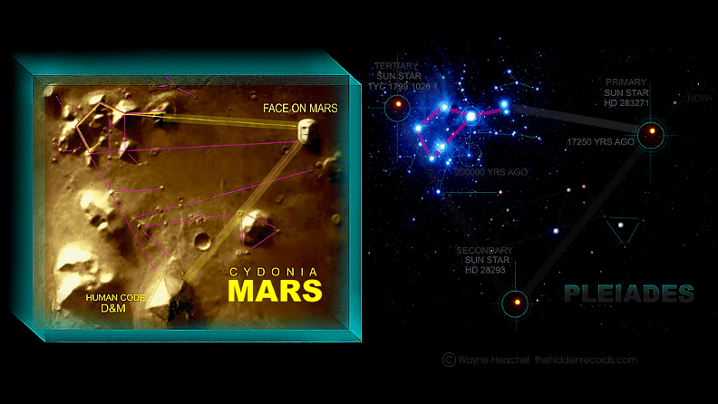
When the image was released it captured some attention but it wasn’t until the face was re-discovered three years later that it really captured the public’s imagination. Computer engineers Vincent DiPietro and Gregory Molenaar, under contract at NASA’s Goddard Space Flight Center, had been intrigued by the face and another nearby structure shaped like a pyramid, now called the D&M pyramid after its two discoverers. Poring over NASA picture archives they found 10 images taken of the face and surrounding area but only 2 where high-resolution of the face. Using a new software they had developed called SPIT (Starburst Pixel Interleave Technique) they were able to digitally enhance the images. The results of enhanced images appeared to reveal more detail of the face including, “mouth, teeth, eye sockets, eyeball and pupil, and hairline or headress, and the FACE appears to be bysymmetrical.”
The Monuments of Mars

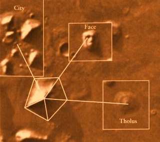
Some of the "Monuments of Mars" see the so-called pyramid in the bottom right hand corner.
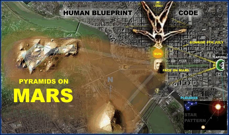
By this time public interest in the face and the potential of a lost civilization on Mars exploded. A cottage industry of books, conventions, science fiction plots about the Face on Mars quickly sprung up seemingly lead by Richard Hoagland. In his book The Monuments of Mars: A City on the Edge of Forever he talks about the face and other surrounding formations that he and others have deemed evidence of a lost civilization. Included in these other “structures” are a pyramid, fortress, ruins of a city, and much more. Fringe groups who have thought that the pyramids of Egypt and South America were either inspired by or actually built by Aliens quickly pounced on the pyramid civilization on Mars theory as proof that Aliens have visited both planets. Aerial images of the pyramid do look similar to the shots of the supposed pyramid on Mars. However, if the Face on Mars was an artificial structure why does it look straight up? The face itself is huge if you were to stand on the ground surrounding the structure you would have trouble making out the features so why would a civilization spend vast amounts of energy building something that they couldn’t even enjoy? Past civilizations on Earth have always built great monuments like this in a standing or upright sitting position i.e. Sphinx so that they could be viewed by worshippers/subjects on the ground. While Hoagland and his fellow band of believers were working themselves into a fevered pitch pointing out new artificial landmarks on the Martian landscape NASA was preparing to the next Mars visitor. The Mars Global Surveyor (MGS) began orbiting Mars on September 12, 1997, and much to the shock of the proponents of an artificial life on Mars NASA did not first go to Cydonia to re-map the Face of Mars. NASA scientists refused to acknowledge that the Face of Mars be a priority and stated something to the effect of, we’ll get around to it eventually. The public outcry was so great to revisit the Cydonia region that NASA was forced to change its timetable and agreed to re-photograph the Face of Mars and surrounding formations as soon as possible.
Picture Taken On:
July 25, 1976 as the Viking 1 space probe orbited Mars
|
|
Place:
40.8° N, 9.6° W Mars
|
Behind the Camera:
Viking I space probe
|
Picture Summary:
A mountain formation on Mars that looks like a face.
|
 This image is in the public domain because it was taken by NASA This image is in the public domain because it was taken by NASA |
|
http://www.famouspictures.org/face-on-mars/
|
|
|
|
|
|
|
|
Viking 1 & 2
Mission Type:Orbiter & Lander pairs
Launch Vehicle: Titan IIIE/Centaur
Launch Location: Cape Canaveral Air Force Station, Florida
Viking 1 Orbiter & Lander
Launch: August 20, 1975 UTC
Orbit Insertion: June 19, 1976
Orbiter End of Mission: August 17, 1980
Landing: July 20, 1976
Landing Site: Chryse Planitia ("Golden Plain")
Lander End of Mission: November 13, 1982
Viking 2 Orbiter & Lander
Launch: September 9, 1975 UTC
Orbit Insertion: August 7, 1976
Orbiter End of Mission: July 25, 1978
Landing: September 3, 1976
Landing Site: Utopia Planitia, Mars
Lander End of Mission: April 11, 1980
Overview
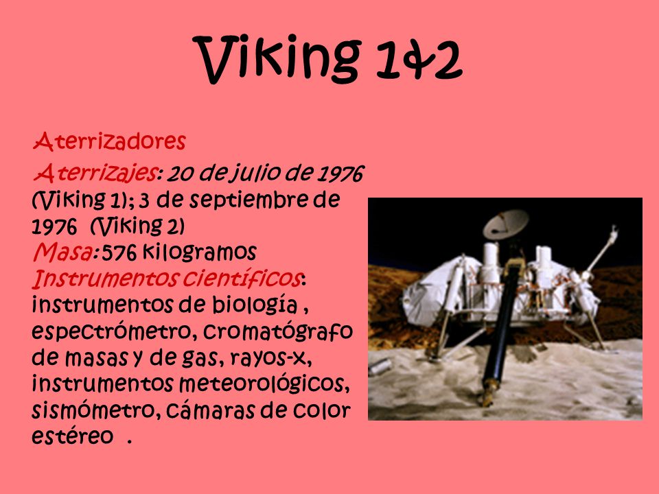
NASA's Viking Project found a place in history when it became the first U.S. mission to land a spacecraft safely on the surface of Mars and return images of the surface. Two identical spacecraft, each consisting of a lander and an orbiter, were built. Each orbiter-lander pair flew together and entered Mars orbit; the landers then separated and descended to the planet's surface.
The Viking 1 lander touched down on the western slope of Chryse Planitia (the Plains of Gold), while the Viking 2 lander settled down at Utopia Planitia.
Besides taking photographs and collecting other science data on the Martian surface, the two landers conducted three biology experiments designed to look for possible signs of life. These experiments discovered unexpected and enigmatic chemical activity in the Martian soil, but provided no clear evidence for the presence of living microorganisms in soil near the landing sites. According to scientists, Mars is self-sterilizing. They believe the combination of solar ultraviolet radiation that saturates the surface, the extreme dryness of the soil and the oxidizing nature of the soil chemistry prevent the formation of living organisms in the Martian soil.
The Viking mission was planned to continue for 90 days after landing. Each orbiter and lander operated far beyond its design lifetime. Viking Orbiter 1 continued for four years and 1,489 orbits of Mars, concluding its mission August 7, 1980, while Viking Orbiter 2 functioned until July 25, 1978. Because of the variations in available sunlight, both landers were powered by radioisotope thermoelectric generators -- devices that create electricity from heat given off by the natural decay of plutonium. That power source allowed long-term science investigations that otherwise would not have been possible. Viking Lander 1 made its final transmission to Earth November 11, 1982. The last data from Viking Lander 2 arrived at Earth on April 11, 1980.
https://marsmobile.jpl.nasa.gov/programmissions/missions/past/viking/
|
|
|
|
|
The Face on Mars: Fact & Fiction
By Nola Taylor Redd, Space.com Contributor | August 20, 2012 03:02pm ET
When the Viking 1 mission returned photos of the Martian surface in 1976, the image of a rocky face in the Cydonia region captured the public eye. Was it a trick of light and shadows? A remnant of an ancient civilization? Let's take a look at this intriguing landform.
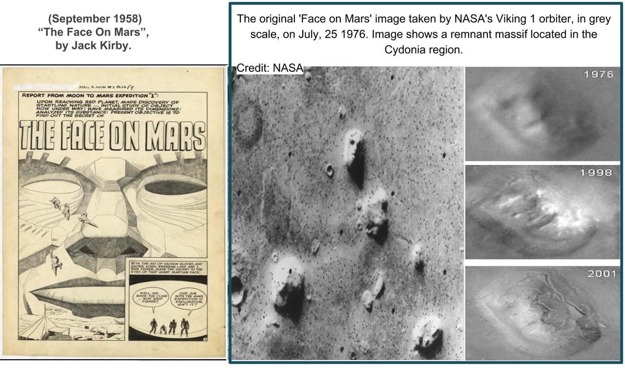
The original 'Face on Mars' image taken by NASA's Viking 1 orbiter, in grey scale, on July, 25 1976. Image shows a remnant massif located in the Cydonia region.
Credit: NASA
Discovery and study
As the Viking 1 mission circled the red planet in search of a landing site for its sister ship, Viking 2, it snapped photos of Mars for engineers at NASA to study. On July 25, 1976, it captured the image of a pile of rocks that greatly resembled a human face. When NASA released the photograph almost a week later, they described it as a "huge rock formation in the center [of the photo], which resembled a human head."
Although NASA scientists quickly determined that the face was created by tricks of light and shadows, the imaginative public seized on the idea that it did not form naturally. Some people believe that the face is the remnant of an alien civilization, suggesting that other rocky outcroppings in the area may be a crumbling extraterrestrial city. Since 1976, the face has appeared in a number of popular culture references citing it as an indication of life on Mars at some stage of the planet's history. Books, movies and television have all taken part in speculation on the "true" origin of the Martian rubble. [Face on Mars: Why People See What's Not There]
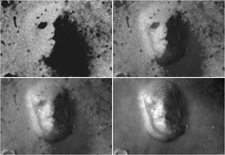
In April 1998, NASA's Mars Global Surveyor took more detailed images of the face. Other high resolution images subsequently taken by the Mars Reconnaissance Orbiter and the European Space Agency's Mars Express revealed that original analysis of the images was correct; the suggestion of a face is an optical illusion revealed only as the light hits the surface and wells of the rocks at specific angles.
A look at how our view of the face on Mars has changed over time
Credit: NASA
Making faces on Mars
The face on Mars lies in an area known as the Cydonia region, which falls between the planet's cratered southern highlands and the smoother northern plains. Some scientists think this area would have once lain near a giant Martian ocean, back when the planet had enough of an atmosphere to hold water on its surface.
A close-up view (from above) the Martian Happy Face, Crater Galle, in false-color.
Credit: ESA/DLR/FU Berlin (G. Neukum)
The rocky outcropping that creates the illusion is approximately a mile across and bears a resemblance to buttes or mesas from the American West. It likely formed from a combination of landslides and collected debris. [VIDEO: Life on Mars – The Search Continues]
Other mesas are scattered across the Cydonia region, and the orbiters have measured them while circling over the area. The results revealed that there was nothing unique about the structural formation of the face itself; it resembles its neighboring landforms. Both the Global Space Surveyor and the Mars Express captured enough data to create a three-dimensional look at the fascinating formation.
Although one of the most popular landmarks on Mars, the face is by no means the only group of rocks to lie in a visually pleasing configuration. Viking captured several other intriguing images, including the Galle crater in the southern highlands, boasting a curved mountain range and two mountain clusters that create the appearance of a smiley face. A lava flow pattern on the large volcano Alba Patera looks a great deal like the popular Muppet Kermit the Frog. The Mars Express images captured a skull-shaped mesa. And other, vaguer faces dot the surface of the red planet. [Image Gallery: Mars Illusion Photos]
Such structures are not particularly indicative of alien life. Even on Earth, formations such as the "Old Man of the Mountain" in New Hampshire can create aesthetically pleasing imagery without extraterrestrial intervention.
— Nola Taylor Redd. SPACE.com Contributor
https://www.space.com/17191-face-on-mars.html
|
|
|
|
|


 
SIRIO ES LA CONSTELACION DEL PERRO/ CAN MAYOR
 EL MISMO DISEÑO DE ORION EL MISMO DISEÑO DE ORION
99. Ezequiel 22:7: Al padre y a la madre despreciaron en ti; al EXTRANJERO trataron con violencia en medio de ti; al huérfano y a la viuda despojaron en ti.
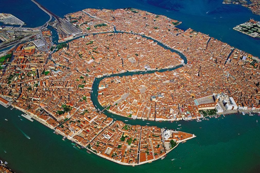
NOTEN EL NEXO DE DAN, CON LA SERPIENTE (VENECIA) Y EL CABALLO (PLAZA SAN MARCOS)
7. Génesis 49:17 Será Dan SERPIENTE junto al camino, Víbora junto a la senda, Que muerde los talones del caballo, Y hace caer hacia atrás al jinete.
VENECIA=PLAZA SAN MARCOS
11. Proverbios 25:11 MANZANA de oro con figuras de plata Es la palabra dicha como conviene.
12. Cantares 2:5 Sustentadme con pasas, confortadme con MANZANAs; Porque estoy enferma de amor.
13. Cantares 7:8 Yo dije: Subiré a la palmera, Asiré sus ramas. Deja que tus pechos sean como racimos de vid, Y el olor de tu boca como de MANZANAs,
ALLI ESTA LA CONEXION VENUS / VENECIA CON EL 666
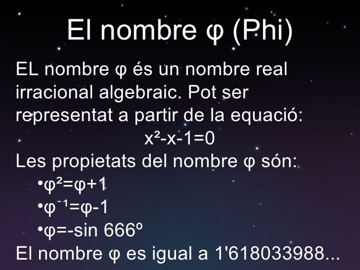
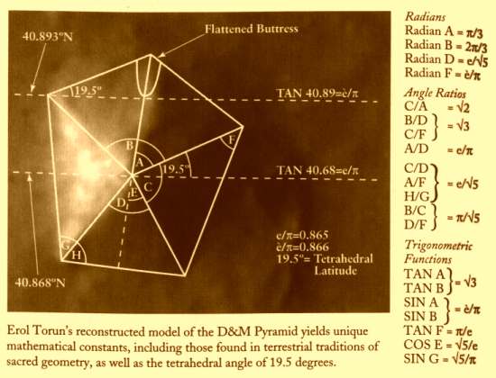
VENUS= PENTAGONO= VENECIA= NUMERO DE ORO= 1.618033
LAS MATEMATICAS SON EXACTAS.
GLORIA A DIOS TODOPODEROSO. QUE BELLAS SON LAS MATEMATICAS
|
|
|
|
|
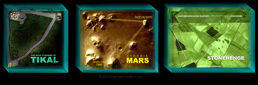
La conexión Tierra-Marte – Código Oculto
Posted By: Terror y Misterio 22 octubre, 2017
Cuando analizamos las antiguas construcciones existentes en Egipto, como la famosa Esfinge con su enorme rostro humano coronado por un elaborado tocado, notamos un parecido extraordinario a la Cara en Marte. No solo eso, tanto la Esfinge como la Cara de Marte se encuentran muy cerca de unas gigantescas pirámides. ¿Podría ser esto una mera casualidad? Tiene que haber una conexión, una conexión Marte-Tierra.
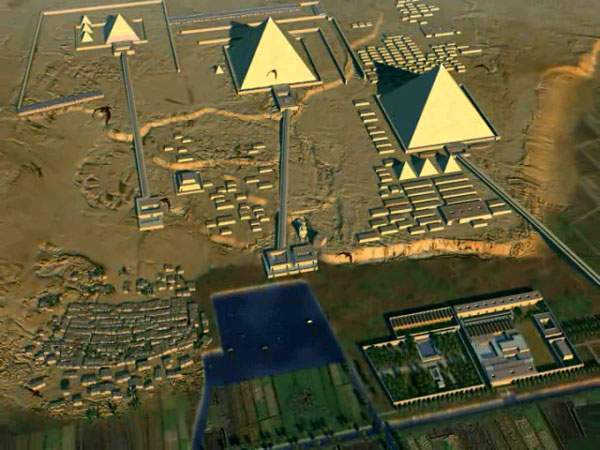
Cuanto más pensamos en estas «similitudes» (una cara y pirámides en Marte) más tendemos a pensar en todas las estructuras megalíticas aquí en la Tierra. Tenemos grandes monumentos de piedra que se encuentran en todos los continentes, sin embargo, no sabemos con certeza quién los construyó y con qué fin. Un ejemplo perfecto son las pirámides de Giza.
La visión tradicional
De acuerdo con la corriente principal de la ciencia, las pirámides de Egipto fueron construidas durante un siglo y medio aproximadamente desde aproximadamente el año 2.630 hasta 2.490 a.C. La más grande de las pirámides, ubicada cerca de la Esfinge en la meseta de Giza, generalmente data del 2.550 a.C. con 147 metros de altura, fue el monumento más alto del mundo hasta el siglo XIX. La Gran Pirámide de Giza consta de casi dos millones y medio de bloques de piedra, cada uno con un peso de entre 2,5 y 15 toneladas. Los científicos estiman que estos bloques masivos tendrían que haberse establecido a razón de uno cada dos minutos y medio. ¿Qué tipo de fuerza de trabajo podría haber sido capaz de una hazaña tan impresionante dada la tecnología de la época?
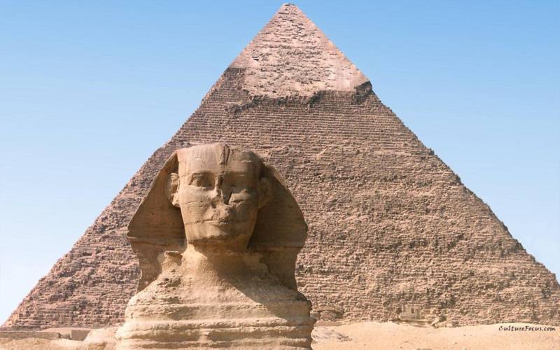
Si le preguntas a un egiptólogo «¿Quién construyó las pirámides?», Responderá que los antiguos egipcios dedicados a sus faraones las construyeron. Basan esta teoría en tallas en la pared y jeroglíficos que representan a los trabajadores moviendo grandes bloques de piedra.
Pero la verdadera pregunta debería ser «¿Dónde están las herramientas que usaron?» Los grandes sitios de cantera de hoy en día usan maquinaria muy grande para llevar a cabo estas monumentales tareas. ¿Dónde están las máquinas o herramientas avanzadas que usaban los antiguos egipcios? La Gran Pirámide de Giza se encuentra en el centro de un complejo extremadamente elaborado que incluye muchas pirámides más pequeñas, templos y varias tumbas. No es suficiente decir que 20,000 personas trabajando 80 años seguidos podrían haber construido todo esto sin el uso de grandes sitios de cantera o herramientas para excavar las piedras usadas.
Ha surgido nueva evidencia que plantea aún más preguntas sobre el propósito real de las pirámides, así como su fecha de construcción. Al utilizar el software de asignación de estrellas en una PC, podemos determinar dónde se ubicarán las estrellas en un momento específico en el futuro o en el pasado. Esto es útil para poder localizar constelaciones de estrellas específicas.
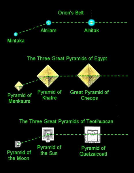
El uso del software de mapas estelares en la meseta de Giza revela información interesante sobre las tres Pirámides y la Esfinge ubicadas allí. Resulta que las tres Pirámides de Giza forman un mapa terrestre de la constelación de Orión, ya que Orión habría aparecido en 10.500 a.C. Además, en esa fecha exacta, la Esfinge (una criatura con la cara de un humano y el cuerpo de un león) mira hacia el este directamente en la constelación de LEO, el león.
¿Es esto solo una coincidencia? ¿Cómo pudieron los egipcios del año 2.500 aC construir las pirámides de Giza para coincidir exactamente con la constelación de Orión del año 10.500 a.C?
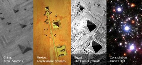
Pirámides de Giza alineadas con Orión
Es cierto que los principales monumentos de Giza forman un mapa terrestre preciso de las tres estrellas del cinturón de Orión, ya que estas constelaciones aparecieron en 10.500 a.C ¿Quién podría haber estado observando los cielos sobre Giza en 10.500 a.C y quién, en esa fecha, podría haber tenido la capacidad técnica para realizar trabajos tan monumentales como la Esfinge y las Pirámides? Los egiptólogos afirman que no había civilizaciones en la Tierra en ese momento, y menos capaces de planificar y construir estructuras tan grandes y bien diseñadas.
Si están en lo cierto, ¿por qué las alineaciones de Giza reflejan tan clara y repetidamente los cielos del undécimo milenio a.C? Puede haber una «conexión terrestre» entre Giza y Cydonia, la región de Marte donde se encuentran las estructuras misteriosas, tal vez una fuente común que imparte el mismo legado de conocimiento y simbolismo en ambos mundos.
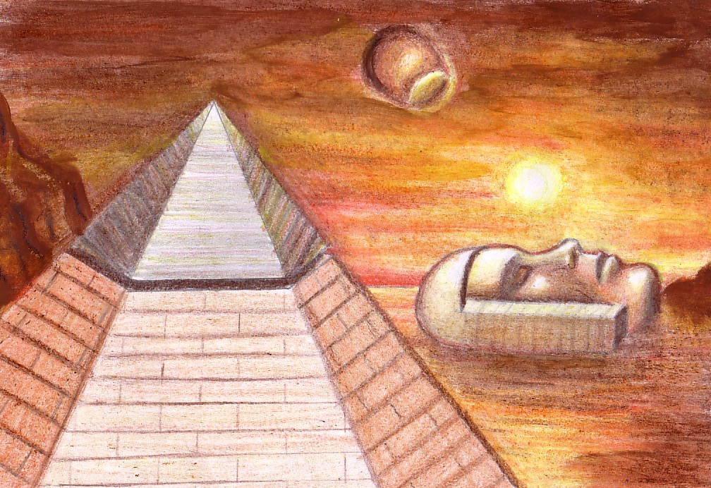
Representación artística de Cydonia en Marte
Si las estructuras se crearon inteligentemente, ¿cuál fue su propósito? Cuando miras detenidamente la imagen de abajo, puedes ver claramente lo que parece ser una diferencia de terreno en el lugar donde estaría la costa si la ciudad estuviera en el borde de la Tierra. La cara se coloca de una manera que sería visible desde la ciudad. También lo son otras características clave en esta área, como la pirámide de D & M.
¿Es esto solo una coincidencia? No. La geología sola habla por sí misma. Independientemente de si la diferencia de superficie es causada por el agua. Solo mirando la imagen y las anomalías en la región, parece bastante posible que Cydonia haya sido construida justo al borde del agua. En la Tierra, aquí es donde comúnmente construimos propiedades frente al mar.
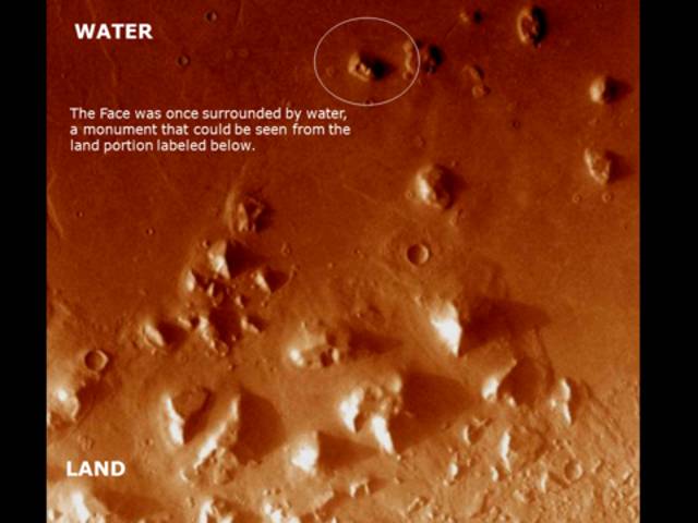
Evidencia geológica
La Esfinge de Giza, también, se encuentra en la orilla oeste del río Nilo. Observe la diferencia de color y el terreno ondulado cerca de todas las estructuras piramidales en la región de Cydonia. Estas características bien podrían indicar que las pirámides estaban ubicadas en tierra. La cara, sin embargo, está rodeada por una superficie de color menos nudosa y más clara.
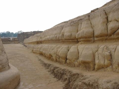
Se dice que la Esfinge fue construida entre 2.558 y 2.532 antes de Cristo. Existe una fuerte evidencia geológica de que la Esfinge ha sido fuertemente erosionada por el agua en algún momento de su pasado. La naturaleza de la intemperie sugiere que fue causada por fuertes lluvias durante un largo período de tiempo. Si la Esfinge fue, de hecho, construida alrededor del 2.500 a.C, como afirman los principales científicos, eso colocaría su construcción mucho después de los cambios climáticos que transformaron a Egipto en un paisaje árido.
http://terrorymisterio.com/la-conexion-tierra-marte-codigo-oculto/
|
|
|
 Primer
Anterior
10 a 24 de 159
Siguiente Primer
Anterior
10 a 24 de 159
Siguiente Último
|